



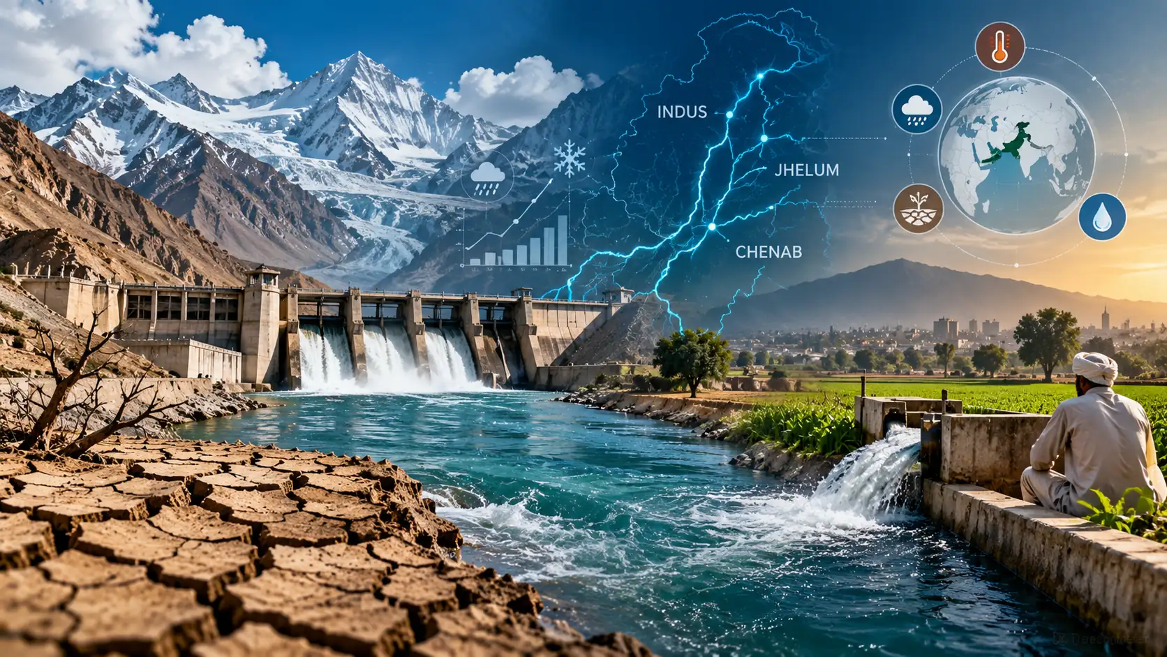
WHEN WATER BECOMES UNCERTAIN, TRUST MUST BECOME MEASURABLE
One River, Four Provinces and the Challenge of Governing Water in a Changing Climate
By Dr Khalid Khan
Synoptic Systems Architect and Climate Intelligence Lead, PlanetPulse
Umama Khalid
International Relations, Creative Ghar
Pakistan’s provinces do not need to have identical interests in the Indus. Federalism exists precisely because geography, economies, infrastructure and development needs differ.
But there is something they increasingly need to share:
confidence in the river they are measuring.
Pakistan reached a historic interprovincial settlement over the Indus waters in 1991. Thirty-five years later, the Water Apportionment Accord remains the foundation of interprovincial water distribution. Yet the physical system surrounding that compact is changing.
Snow and glaciers are changing. Rainfall and runoff patterns are shifting. Floods and droughts can become more disruptive. Water can arrive at different times and in different extremes. Agricultural and urban demands are evolving. Historical hydrology, while indispensable, is becoming a less complete guide to future conditions.
This does not necessarily mean Pakistan needs a new water bargain.
It means the existing bargain increasingly needs better intelligence around it.
The 1991 Bargain
The 1991 Accord was a major achievement of cooperative federalism. It established provincial allocations and subsequently gave rise to the Indus River System Authority, created under the 1992 IRSA Act to regulate and monitor distribution in accordance with the Accord. A detailed CSIRO–IWMI examination describes the Accord as a 14-paragraph framework for sharing Indus surface waters seasonally among Punjab, Sindh, Khyber Pakhtunkhwa and Balochistan.
Under Paragraph 2, annual allocations are 55.94 million acre-feet (MAF) for Punjab, 48.76 MAF for Sindh, 5.78 MAF for KP and 3.87 MAF for Balochistan, totalling 114.35 MAF, with a separate provision of 3 MAF for KP’s ungauged Civil Canals above the rim stations.
But the Accord is more than a table of numbers. It also addresses shortages and surpluses, flood supplies, future storage, ten-daily operations and provincial flexibility. Balance river supplies, including flood supplies and future storages, were divided 37% each to Punjab and Sindh, 14% to KP and 12% to Balochistan.
The Accord therefore should not be caricatured as an inflexible arrangement for an entirely predictable river.
Its framers understood variability.
What they could not fully anticipate was the scale and complexity of climatic change now affecting the wider Indus system.
One River, Different Vulnerabilities
Each province encounters the Indus differently.
Punjab sustains an enormous irrigated agricultural system. Sindh’s lower-riparian geography makes upstream flows, timing and reservoir releases especially consequential, while the province also carries the ecological challenge of the Indus Delta and seawater intrusion.
KP combines mountain and tributary hydrology with a different irrigation and infrastructure profile. Balochistan combines aridity, groundwater dependence and constraints in surface-water infrastructure.
These differences do not establish that one province is right and another wrong.
They establish something more useful:
Water security is not determined by entitlement alone. Geography, timing, infrastructure, storage, demand and the capacity to use available water all matter.
That principle becomes increasingly important as the climate changes.
When Yesterday Becomes a Less Complete Guide to Tomorrow
Paragraph 14 of the Accord is particularly interesting from a Climate Intelligence perspective. It provides for ten-daily allocations and uses average system uses during 1977–82 as a guideline for developing the regulation pattern.
Historical observations remain essential. But climate change introduces non-stationarity: past hydrological behaviour cannot always be assumed to reproduce itself in the future.
A 2026 process-based study of the Upper Indus Basin found an intensification of the hydrological cycle over its 1951–2019 modelling period. It estimated that snowmelt and glacier melt together contributed approximately 65% of total annual runoff, while also finding an earlier onset of snowmelt in recent decades and substantial differences by elevation.
This does not justify a simplistic prediction that the entire Indus will have a particular percentage less water.
Pakistan’s climate-water challenge is not merely how much water the Indus carries. It is increasingly when it arrives, in what form, with what extremes, where it can be stored, and whether institutions can anticipate those changes.
More water at the wrong time can produce a flood. Too little when crops require it can produce scarcity. Annual averages can conceal both.
Measurement Is Also About Trust
This is where climate science meets federal governance.
Water measurement has itself been a source of interprovincial concern. That makes Pakistan’s current investment in automated telemetry particularly important.
The federal Planning Commission approved a revised project costing approximately Rs23.835 billion for real-time discharge monitoring at 27 key sites across the Indus Basin Irrigation System. The project is intended to provide accurate online information on water availability, flows and gate positions, strengthening transparency and confidence in water distribution.
This is not merely an engineering improvement.
A trusted gauge can also become an instrument of federal trust.
Yet telemetry alone is not Climate Intelligence.
Telemetry answers: How much water is here now?
Climate Intelligence must increasingly help answer: What may come next?
How much snow is stored in the mountains? When might it melt? What rainfall is expected? What is the probability of an extreme flood or drought? What are reservoir conditions? What is happening underground? Where is demand rising? And what decisions should different forecasts trigger?
That requires connecting information too often treated separately:
Snow & Glaciers → Weather → Rivers → Reservoirs → Barrages & Canals → Groundwater → Agriculture → Cities → Ecosystems
FROM WATER ACCOUNTING TO WATER CLIMATE INTELLIGENCE
OBSERVE → VERIFY → FORECAST → SIMULATE → SHARE → DECIDE → LEARN
This does not require another bureaucracy. It does not require replacing IRSA. And it does not imply rewriting provincial water rights.
It means creating a stronger intelligence layer around the constitutional and institutional architecture Pakistan already possesses.
From Four Measurements to One Shared Picture
Imagine a Shared Indus Water Picture available to the relevant federal and provincial institutions.
It would integrate:
Observed water — what is flowing now.
Stored water — what reservoirs and, progressively, aquifers contain.
Allocated water — what lawful arrangements provide.
Delivered water — what calibrated measurements record.
Forecast water — what scientific models indicate may arrive.
Demand — what agriculture, cities, industry and ecosystems require.
Uncertainty — how confident are we?
That last category is crucial.
Climate Intelligence should not manufacture certainty where none exists.
It should make uncertainty visible enough to govern.
Such a system would not eliminate disagreement. Nor should it. Provinces can legitimately differ over development priorities, infrastructure, environmental requirements and interpretations of policy.
But there is an important distinction between disagreeing over policy and disagreeing over the basic facts from which policy begins.
Pakistan should progressively make the second problem smaller.
Climate-Ready Water Federalism
This is why climate change need not become an argument for reopening the 1991 settlement.
It can instead become an argument for strengthening its implementation.
The Accord already contains mechanisms for dealing with variability. IRSA already provides a federal institutional platform. Pakistan already possesses hydrological agencies, meteorological capabilities, satellite information, reservoir-management systems and provincial irrigation departments.
The challenge is increasingly to connect them.
That is also how external water uncertainty should be approached. Questions arising under the Indus Waters Treaty with India are distinct from Pakistan’s domestic water-sharing arrangements. External pressures should therefore not automatically be converted into predictions of conflict among Pakistan’s provinces.
The more constructive principle is the opposite:
The greater the uncertainty outside the federation, the stronger the evidence and cooperation required within it.
Climate Intelligence cannot determine provincial rights. Law, constitutional processes and agreed federal institutions do that. Nor can technology decide what constitutes fairness.
But Climate Intelligence can help ensure that decisions are based on a common understanding of what the river is doing, what it may do next and how uncertain that knowledge remains.
Pakistan does not need its provinces to have identical interests.
Four provinces may see their interests differently.
They should not have to see four different rivers.
The Indus is changing. Our capacity to observe it, anticipate it and govern it together must change too.
WHEN WATER BECOMES UNCERTAIN, TRUST MUST BECOME MEASURABLE.
Selected Scientific & Institutional Sources
Government of Pakistan / Indus River System Authority. Water Apportionment Accord, 1991; and Indus River System Authority Act, 1992.
CSIRO–IWMI. 1991 Inter-Provincial Water Apportionment Accord (WAA) Tool: User Guide and Reference Manual.
Government of Pakistan, Planning Commission. Installation of Telemetry System for Real-Time Discharge Monitoring at 27 Key Sites on the Indus Basin Irrigation System.
Journal of Hydrology: Regional Studies (2026). “Long-term hydrological dynamics and water balance in the Upper Indus Basin: Insights from a process-based model.” Volume 64, Article 103259.